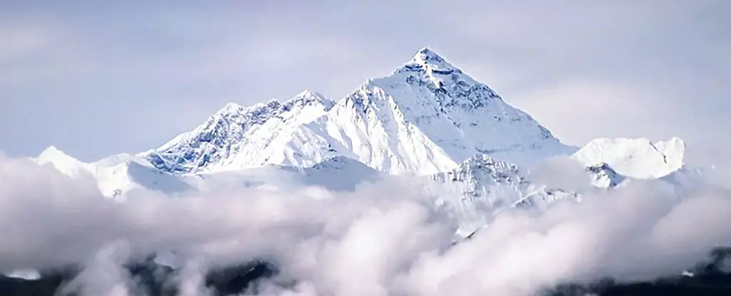
Mount Everest, towering at an astonishing 8,849 meters, remains an enduring symbol of natural grandeur and scientific curiosity. While the traditional understanding of its height has revolved around the collision of tectonic plates—a process that continues to shape the Himalayas—recent research introduces a compelling twist to this narrative. The concept of ‘geological piracy’ emerges as a critical player in explaining how Everest stands so distinctly apart from its neighboring peaks. This article delves into the intricacies of this phenomenon and how it contributes to Everest’s ever-rising stature.
Geological piracy refers to the process by which one river diverts water from another, profoundly altering sediment distribution and erosion patterns within a landscape. Traditionally associated with the notion of a river ‘capturing’ another, this natural process can significantly reshape geographic features and promote variations in elevation across mountain ranges. In the case of Mount Everest, studies conducted by experts from the China University of Geosciences and University College London suggest that this very process could account for up to 50 meters of its current height, an extraordinary revelation in the field of geology.
Central to this hypothesis is the Arun River, which today flows decisively through the Himalayan region, carving a stunning gorge as it makes its way down from the mountains. What sets the Arun apart from other rivers in the area is its history; approximately 89,000 years ago, the Arun began to capture significant water from the Kosi River, its parent tributary. The implications of this capture are monumental. With the acquisition of additional water, the Arun gained unparalleled erosive power, allowing it to incise deep gorges and rapidly transform the surrounding landscape.
The advancements in science provide evidence that the flows of the Arun River, rather than merely tectonic activities, have played a crucial role in sculpting the region’s geography. This readjustment caused by the torrential flow initiated a series of changes that ultimately propelled some segments of the Earth’s crust upward, increasing the elevation of Everest and surrounding mountains.
As the Arun River efficiently excavated its gorge, it removed substantial volumes of material from the crust, causing the land to ‘rebound’ in response. This rebound phenomenon is a reflection of the crust’s elastic properties, where the removal of weight allows it to rise in certain areas. Research teams estimate that this uplift could reach rates of nearly 0.53 millimeters annually for Everest, suggesting that the mountain continues to evolve as rivers reconfigure the landscape even today.
Moreover, while mountains in the region experience a relatively steady rate of erosion due to other rivers maintaining a stable flow, the disruption introduced by the Arun’s capture of the Kosi’s waters led to a dramatic imbalance. This imbalance not only allowed for the new uplift rates but also meant that the surrounding topography was continually reshaped by forces beyond just tectonic uplift.
The introduction of geological piracy as a significant factor in Everest’s altitude has vast implications for the broader field of geology. It encourages scientists to reexamine other mountain ranges and propose that river dynamics may be as crucial to their formation and height as tectonic movements. This evolving understanding challenges long-held assumptions about how geological features emerge and change over time.
Further research into the mechanics of river systems, erosion rates, and geographic redistribution of sediment will undoubtedly shed light on various mountain ranges worldwide. The case of Mount Everest serves as a reminder of how interconnected natural processes are in shaping our planet, emphasizing that height, stability, and erosion can be influenced by something as dynamic as river systems rather than just static geological forces.
Mount Everest’s majestic height is a composite of ancient geological forces and modern discoveries, crafted by the relentless power of rivers and shaped by the inherent dynamism of Earth’s crust. As scientists continue to unravel the complexities behind Everest’s formation, the interplay of geology and natural forces promises to unveil new narratives and understandings of our planet’s awe-inspiring landscapes.
Leave a Reply